The morning after our explosive community meeting, I woke to light filtering through the windows of the same one-room wooden building that hosted the meeting. Excited for the day, I jumped/rolled out of my hammock and mosquito net, looking anything but graceful in the process. Surprisingly, this wouldn’t be my least graceful move of the day.
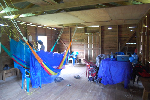
Home sweet home
It was the day of the assessment, and by all accounts, we had a full day ahead of us. I’d be joining private consultant Paul Walker, SATIIM Park Rangers, village leaders, and the international interns to trudge through the jungle of Conejo and the Sarstoon Temash National Park to assess the damage caused by the 3-mile long, 8-foot wide seismic line that U.S. Capital Energy cut. While the illegal line had been discovered before exploratory drilling began, damage had been done, and we were going to document the damage in the event that Conejo decides to request reparations.
And so, at 7:30 in the morning (we delayed our departure to allow the rivers and streams to reduce in volume from the night’s rain), our rag tag, machete wielding, rainboot wearing group set out, complete with a gunman in case of croc attacks. We had been told it would be a 45-minute walk just to make it to the seismic line, where our work would really begin. That 45-minute walk turned into a 2.5 hour walk, as we trudged up muddy, manure-y, suction-y hills, carefully choosing each step to avoid losing a boot to the mud forever (my least graceful moments of the day), slugged through waist- high swamp water, and tiptoed across submerged logs serving as make-shift bridges through the flooded rivers, allowing us a waist-deep walk rather than a strong swim.
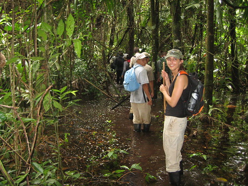
Swamp life
As we continued deeper into the jungle, wading deeper into the water (much of the Sarstoon Temash National Park is a mangrove swamp, and we are in the middle of the wet season), the scenery was mesmerizing. This was easily the deepest jungle I had ever explored. The vegetation, at times, seemed to be closing in on you.
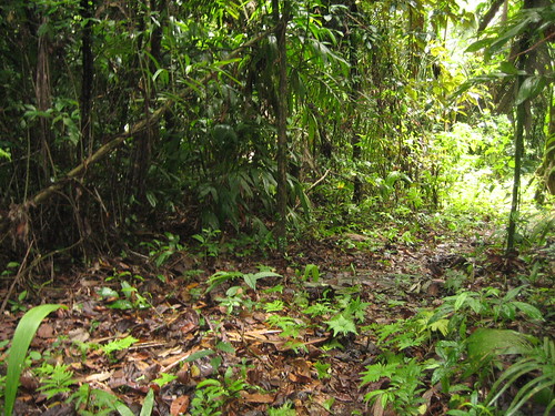
2.5 hours later, our workday was just starting; we had made it to the seismic line. For the next few hours, we moved slowly along the seismic line, taking note of every plant and tree that had been cut down or trampled when the line was cleared, and recording its purpose.
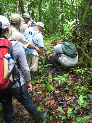
Thomas identifies a plant
Around 12:30, upon reaching what I can only categorize as full-on swamp, we stopped for a quick lunch to fortify ourselves for the next half of the day. Gone was the dry land we had been walking for the past hour or so. The next half of the day would be a complete swamp slog. And the first part? That would be a knee-deep walk across croc territories until reaching a dark brown, deep river. While one member of the party was off croc spotting, another was cutting a branch to serve as our anchor pole as we walked in waist deep water across a very, very skinny log, and still another was cutting into a wall of green. That would, apparently, be our path.
Waist-deep in water and nose-deep in sulfur smells, we continued documenting the damage. To the untrained eye, the seismic line, with five months to regenerate, looked no different than a hiking path. Well, a hiking path that has been cut with no regard for the towering trees. To the rangers and community members however, the seismic line was a jagged scar, and the damage was everywhere, from small, medicinal plants, to those same towering trees I noticed.
Seismic Line
When we reached a point where we could go no further unless we were prepared to swim the rest of the assessment, and knowing we had a 2 hour hike back and no defined path, we decided it was time to return to Conejo. The plan? Follow the creek, necessitating river swims and mud slogs.
After finally emerging from the jungle ten hours after we departed, I sat on the steps of the town hall, looking out over Conejo and the jungle surrounding it, and my thoughts returned to the meeting from the night before. The jungle and swamp of the Sarstoon Temash National park are breathtaking, beautiful, and unique. I have a hard time imagining that landscape ravaged by an oil company. I also have a hard time telling a suffering community that they shouldn’t pursue a potential means of economic and social advancement. As I sat on those steps, I knew there was no easy answer, and that the problem could not be solved in a day. I also knew however, that while we won’t know the results of the damage assessment for some time, we had done a small part in ensuring that U.S. Capital Energy starts toeing the line.
Posted By Laura Burns
Posted Jul 30th, 2012